

(1) Calicut (Kozhikode)
.jpg)
(2) Cambay / Khambat
.jpg)
(3) Cannanore (Kannur)
.jpg)
(4) Chamba
.jpg)
(5) Champaner
.jpg) (6) Chanderi
(6) Chanderi
.jpg)
(7) Chandernagar / Chandannagore
.jpg)
.jpg)
(9) Chanhudaro
%2B-%2BCopy.jpg) (10) Chandravati
(10) Chandravati
%2B-%2BCopy.jpg) (11) Chandragiri
(11) Chandragiri
%2B-%2BCopy.jpg) (12) Chandoli
(12) Chandoli
.jpg) (13) Chaul
(13) Chaul
%2B-%2BCopy.jpg) (14) Chausa
(14) Chausa
.jpg) (15) Chidambaram
(15) Chidambaram
.jpg)


(16) Chinsura
%2B-%2BCopy.jpg)
.jpg)
.jpg)
(19) Chittagong
%2B-%2BCopy.jpg)


(21) Chopani Mando
%2B-%2BCopy.jpg)
.jpg) (23) Cochin(Kochi):
(23) Cochin(Kochi):
%2B-%2BCopy%2B-%2BCopy%2B-%2BCopy%2B-%2BCopy.jpg) (24) Cuddalore
(24) Cuddalore
%2B-%2BCopy.jpg)
- From time immemorial, the city has attracted travellers with its prosperity. It has traded in spices like black pepper and cardamom with Jews, Arabs, Phoenicians, and Chinese for more than 500 years. As Kozhikode offered full freedom and security, the Arab and the Chinese merchants preferred it to all other ports.
- Kozhikode was the capital of Malabar during the time of Zamorins, who ruled the region before the British took over. The city's first recorded contact with Europe was when Vasco da Gama landed in May 1498, as the leaders of a trade mission from Portugal. He was received by the Zamorin himself.
- Later on,the Dutch, English and the French arrived in Kerala. Zamorins allowed the Dutch to trade in Kozhikode and sought their help to drive out the Portuguese. The position of Portuguese weakened gradually due to international events and their position in Kerala deteriorated. the Dutch captured Cochin and Cannanore and established trade.
- Ibn Battuta (1342–1347), who visited six times, gives us the earliest glimpses of life in the city. He describes Kozhikode as "one of the great ports of the district of Malabar" where "merchants of all parts of the world are found".
- Ma Huan (1403 AD), the Chinese Muslim sailor part of the Imperial Chinese fleet under Cheng Ho lauds the city as a great emporium of trade frequented by merchants from around the world. He makes note of mosques built to cater to the religious needs of the Muslims, the unique system of calculation by the merchants using their fingers and toes (followed to this day) and the matrilineal system of succession.
- Abdur Razzak (1442–43) the ambassador of Persian Emperor finds the city harbour perfectly secured and notices precious articles from several maritime countries especially from Abyssinia, Zirbad and Zanzibar.
- The Italian Niccolo dee Conti (1445), perhaps the first Christian traveller who noticed Kozhikode describes the city as abounding in pepper,ginger, a larger kind of cinnamon, myrobalans etc.
- The Russian traveller Athanasius Nikitn(1468–74) describes it as having a "big bazaar."
- Cambay was a flourishing city, the seat of an extensive trade, and celebrated for its manufactures of silk, chintz and gold stuffs.
- The Arab traveler al-Mas'udi visited the city in 915 AD, describing it as a very successful port; it was mentioned in 1293 by Marco Polo, who noted it as a busy port. He mentions that the city had its own king. Indigo and fine buckram were particular products of the region, but much cotton and leather was exported through Cambay. A contemporary Italian traveler,Marino Sanudo, said that Cambeth was one of India’s main two ocean ports. Another Italian, visiting in about 1440, Niccolò de' Conti, mentions that the walls of the city were twelve miles in circumference.
- The Portuguese explorer Barbosa visited the city in the early sixteenth century.He describes the city as very busy and affluent, with merchants coming frequently by sea from the world around.
- Owing principally to the gradually increasing difficulty of access by water by the silting up of the gulf, its commerce has long since fallen away, and the town became poor and dilapidated.
- To the southeast there are ruins of temples and other buildings. These temples belong to the Jains and contain two massive statues of their deities: one black, the other white. The principal one, as the inscription intimates, is Parswanath, carved in the reign of the emperor Akbar; the black one has the date of 1651 inscribed.
- Kannur is sometimes identified with Naura in Periplus of the Erythraean Sea. In the Middle Ages, Kannur was the important port town, on the Laccadive Sea, called Kolathunadu.
- In the twelfth and thirteenth centuries there was trade with Persia and Arabia.
- St. Angelo Fort was built in 1505 by Dom Francisco de Almeida, the first Portuguese Viceroy of India. Portuguese rule over Cananor would last 158 years and then replaced by the Dutch.
- During the 17th century, Kannur was the capital city of the only Muslim sultanate in India, known as Arakkal.
- The earliest rulers were Kolian tribes.
- In the 4th century AD during the Gupta period, the Thakurs and Ranas ruled. From the 7th century, the Gurjara Pratiharas or the Rajput dynasty came into power.
- In 920, Raja Sahil Varman, King of Bharmour, shifted his capital from Bharmour to a more centrally located plateau in the lower Ravi valley, named as Champa after Chamapavati, the King’s daughter.
- Temple, called the Champavati Temple, belongs to the Royal family and the King’s daughter is venerated as a goddess. Every year, since 935, the Minjar festival or fair has been held.It lasts for 21 days, coinciding with the first day of Baisakhi.
- Since Raja Sahil Varman, the dynasty ruled without successful invasion for around a millennium, until the British gained power.The isolation of the town and its rugged hilly terrain is believed to have been a contributing factor to this unusual state of security. Later, Mughal emperors Akbar and Aurangzeb did attempt to annex Chamba but were unsuccessful in subjugating this territory into their kingdoms. Raja Prithvi Singh (1641-1664 AD), who was on amiable terms with Emperor Shahjahan was instrumental in introducing the court life styles of the Mughals.
- Champaner(Muhammadabad) is located in Panchmahal district, founded by Vanraj Chavda of the Chavda Dynasty, in the 8th century.By the later 15th century, the Khichi Chauhan Rajputs held Pavagadh fort above the town of Champaner.
- The young Sultan of Gujarat, Mahmud Begada captured the town and captured the Pavagadh fort on 21 November 1484, He renamed Champaner as Muhammadabad,after which he moved the capital there from Ahmedabad.
- In 1535, after chasing away Bahadur Shah, Humayun captured the fort.
- Sultan Begada built a magnificent Jama Masjid in Champaner, which ranks amongst the finest architectural edifices in Gujarat. It is an imposing structure on a high plinth, with a central dome, two minarets 30 meters in height, 172 pillars, seven mihrabs, and carved entrance gates with fine latticed windows called "jalis"

- Chanderi is located strategically on the borders of Malwa and Bundelkhand. In 11th century, it was dominated by the trade routes of Central India and was proximate to the arterial route to the ancient ports of Gujarat as well as to Malwa,Mewar, Central India and the Deccan. Consequently, Chanderi became an important military outpost.
- Chanderi is mentioned by the Persian scholar Alberuni in 1030. Balban captured the city in 1251. Sultan Mahmud I Khilji of Malwa captured the city in 1438.
- In 1520 Rana Sanga of Mewar captured the city, and gave it to Medini Rai, a rebellious minister of Sultan Mahmud II of Malwa. The Mughal Emperor Babur captured the city from Medini Rai and witnessed the Rajput rite of jauhar.
- In 1540 it was captured by Sher Shah Suri.The Mughal Emperor Akbar made the city asarkar in the subah of Malwa.
- The Bundela Rajputs captured the city in 1586, and it was held by Ram Sab, a son of Raja Madhukar of Orchha.In 1811 Maratha ruler Daulat Rao Sindhia of Gwalior took it. The city was transferred to the British in 1844.
- Chandannagar was established as a French colony in 1673, when the French obtained permission from Ibrahim Khan, the Nawab of Bengal, to establish a trading post on the right bank of the Hughli River. Bengal was then a province of the Mughal Empire.In 1730 Dupleix was appointed governor of the city, during whose administration more than two thousand brick houses were erected in the town and a considerable maritime trade was carried on.
- In 1756 war broke out between France and Great Britain, and Colonel Robert Clive of the British East India Company and Admiral Watson of the British Navy bombarded and captured Chandannagar on 23 March 1757.Thereafter, Chandannagar's importance as a commercial center was eclipsed by that of Calcutta just downriver.The city was returned to France in 1816. It was governed as part of French India until 1950.
- Chandraketugarh is an archaeological site located beside the Bidyadhari river, about 35 km north-east of Kolkata in the district of North 24 parganas.
- Relics of several historical periods.Northern Black Polished Ware (NBPW) relics, later wares dated from about 400 BC to 100 BC contemporary with the Maurya period, as well as from the more recent Kushanas and Gupta periods.
- Chandraketugarh site and surrounding area could be the place known to ancient Greek and Roman writers.
- It is an archaeological site,south of Mohenjo-daro, in Sindh, Pakistan, belonging to the post-urban Jhukar phase of Indus valley civilization.
- Very similar to Harappa and Mohenjadaro in several aspects like town planning, building layout etc.
- For building houses, bakes bricks were used extensively at Chanhudaro and Mohenjo-daro.Several constructions were identified as workshops or industrial quarters and warehouses.
- Evidence of shell working was found at Chanhudaro and bangles and ladles were made at this site.Harappan seals were made generally in bigger towns like Harappa, Mohenjadaro and Chanhudaro which were involved with administrative network.
- Copper knives, spears, razors, tools,axes, vessels,copper fish hooks and dishes were found. Terrecotta cart model, small terrecotta bird, plates, dishes were found.
- Male dancer
- Indus Seals are also found at Chanhudaro is considered as one of the centres where Seals are manufactured.The scale of craft production at Chanhudaro seems much greater than that at Mohenjedaro.
- Bead making factory: An Impressive workshop, recognised as Bead Making Factory, was found which included a furnace.Shell bangles, beads of many materials, stealite seals and metal works were manufactured at Chanhudaro.
- Sesame, which is a native of South Africa, is known from number of Harappan sites, including Chanhudaro, probably grown for oil.Peas are also grown at Chanhudaro.
- Cotton cloth traces preserved on silver or bronze objects were known from Chanhudaro, Harappa and Rakhigarhi.
- Objects of Iron were reported from Chanhudaro, Ahar (Rajastan, India) and Mundigak and this gains importance as it has been claimed that Iron was produced in 3rd Millennium in South Asia Region.
- Village near Mount Abu ,situated on the bank of the West Banas River in Rajasthan. In ancient times it was an extensive town. The old ruins, such as temples, torans and images scattered over the large area, bear testimony to its past glory.
- Chandravati was ruled by the Paramaras of Abu.
- The Ugrasena Panwar founded the Panwar rule at Abu. Raja Bhoja (1010-1050 AD) was an illustrious rulers of this dynasty.
- In 1024 AD, Chandravati was attacked and plundered by Mahmud Ghazni when he passed through Rajasthan to attack Anahilavada. After defeating Prithviraja III in 1192 AD the Muslim army also attacked Chandravati.
- In about 1315 AD Chandravati passed into the hands of Deora Chauhans.
- Rulers of Chandravati patronized literature too. Jain saints wrote some literary works here.
- Chandragiri, is a suburb of Tirupati in Andhra Pradesh. Krishnadeva Raya of Vijayanagara empire was brought up at Chandragiri Fort, before his coronation at Penukonda.
- Chandragiri fort was built in the 11th century, and the Raja Mahal (palace is an example of Indo-Sarcen architecture, architectural style movement by British architects in the late 19th century, of Vijayanagar period) within it.
- Chandragiri was under the rule of Yadava Naidus for about three centuries and came into control of Vijayanagar rulers in 1367. It came into prominence during Saluva Narasimha Rayalu.
- Chandragiri was the 4th capital of Vijayanagar Empire. Rayas shifted their capital to here when Golconda sultans attacked Penukonda.
- In 1646, the fort was annexed to the Golkonda territory and subsequently came under Mysore rule.
- The region covered by the present district was part of the ancient kingdom of kashi. Remains of brick strewn mounds are spread all over the district.
- Village Ramgarh known as birth place of great Aghoreshwari saint shree Kinaram Baba , a great follower of vaishnav faith and also Shiva and Shakta faith.
- In one of the ancient sites in the village Hetampur of the district, there is a fort which is known as “Fort of Hetam”.It is said that this fort was designed and constructed between 14th to 15th centuries by Todar Mal Khatri who was the construction supervisor in the kingdom of Sher Shah Suri. After Mughal period, Hetam Khan, Talukedar and Jagirdar captured this fort.
- Chaul is a former city of Portuguese India,, 60 km south of Mumbai.
- In 1508, the Egyptian Mamluks, allied with the Gujarat Sultanate vanquished the Portuguese in the Battle of Chaul. The first Portuguese settlement at Chaul took place in 1521 with the construction of the first fort .The Portuguese erected a new square stone fortress, named Santa Maria do Castello, which contained a church and dwelling.
- Chausa or Chausagarh is located in the Buxar district.
- This was the first known bronze hoard discovered in the Gangetic valley and consists of a set of 18 Jain bronzes.The oldest is dated between the Shunga and the Gupta period, (from 2nd BC to the 6th Century AD).
- The hoard includes a Dharmachakra showing Dharmachakra supported by two yakshis supported by makaras; a kalpavriksha and sixteen tirthankaras.
- Other well-known hoards of Jain bronzes include Akota Bronzes, found in Gujarat; Hansi bronzes, found in Haryana; and Aluara bronzes, found in Bihar.
- At the Battle of Chausa on June 26, 1539,Sher Shah defeated the Mughal emperor Humāyūn and assumed the royal title of Farid al-Din Sher Shah.
- The town is believed to be of significant antiquity and has been ruled, at different times, by the Medieval Cholas, Later Cholas, Later Pandyas, Vijayanagar Empire, Marathas and the British.
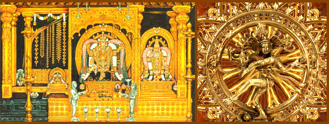
- The town is known for the Thillai Nataraja Temple(Chidambaram Temple).There is no reference to the temple or the town in Sangam literature and the earliest mention is found in seventh century Tamil literature.
- The temple and the deity were immortalized in Tamil poetry in the works of Thevaram by three poet saints belonging to the 7th century - Thirugnana Sambanthar, Thirunavukkarasar and Sundaramoorthy Nayanar.
- There are several inscriptions available in the temple and referring to the Chidambaram temple in neighbouring areas. Most inscriptions available pertain to the periods of Cholas. Pandya inscriptions and Pallava inscriptions are available.Vijayanagara Kings are also mentioned in inscriptions. One of the inscriptions from the descendant of Cheramaan Perumal Nayanar, Ramavarma Maharaja has been found.
- The main temple complex is dedicated to Shiva Nataraja and the complex contains shrines to deities such as Shivakami Amman, Ganesh, Murugan and Vishnu in the form Govindaraja Perumal.The golden tiled roof for the Chit Ambalam (the vimanam) was laid by the Chola King Parantaka I(907-950 CE). Kings Rajaraja Chola I (985-1014 A.D.) made significant donations to the temple. Gold and riches to the temple were donated by Rajaraja Chola's daughter Kundavai II while Chola king Vikrama Chola (1118-1135 A.D.) made donations for the conduct of the daily rituals.
- The temple is made by Dravidian style of architecture and it has nine gateways, and four of these have gateway towers or gopurams each with 7 storeys facing the East, South, West and North. The South gopuram was constructed by a Pandya king[ identified from the presence of the dynasty's fish emblem sculpted on the ceiling.
- Pancha Bhoota Sthalam refers to the five Shiva temples, each representing the manifestation of the five prime elements of nature - land, water, air, sky, fire. All these temples are located in South India. The five elements are believed to be enshrined in the five lingams and each of the lingams representing Shiva in the temple have five different names based on the elements they represent. In the Chidambaram temple, Shiva is said to have manifested himself in the form of sky.
- Nataraja temple is called the Anthaga stalam associated with Anthagam - the third eye. Pancha Sabhai refers to the five places where Lord Shiva is said to have displayed His cosmic dance and all these places have stages or ambalams, also known as Sabhai. Chidambaram has the Ponna Ambalam - the Golden Hall.
(16) Chinsura
- It lies on the Hooghly River, 35 kilometres north of Kolkata The Portuguese founded the town of Ugulim, now Hooghly-Chuchura, in 1579.The city flourished as a trading port and some religious structures were built. One such structure is a church dedicated to Mother Mary brought by the Portuguese.
- In the 17th century,Mughal governor of Bengal expelled the Portuguese.
- In 1656 the Dutch erected a factory on the site of the town. At that time Calcutta was the principal settlement in Dutch Bengal, being used as a base for the Dutch intra-Asian opium trade.In 1759 the garrison of Chinsurah, on its march to Chandernagore, attacked a British force.The Battle of Chinsurah ended with the rout of the Dutch attackers. In 1795, during the Napoleonic wars, a British garrison occupied the settlement. The peace of 1814 restored Hughli to the Dutch. However, in 1825, the Dutch ceded many of their possession in India to the British, in exchange for the British possessions in Sumatra.
(17) Chirand
- Chirand is situated near Chapra.The village with an extensive mound is situated on the bank of the Ganga.
- Chirand has given a continuous cultural sequence beginning from the Neolithic to the Pala period.
- The Chirand Neolithic community practiced agriculture and evidence for wheat, rice, mung, masur, peas has been found. The agricultural tools must have been of stone, bone or wood but agriculture was not on a large scale, because hunting tools and bones of animals, fish and mollusces and birds suggest popularity of non-vegetarian diet. People lived in huts, circular in plan, made of mud and reeds.Food was cooked in ovens.
- Both stone and bone-tools were found.We found quite a number of microliths, which as in Neolithic sites of South India.
- Pottery was decorated in many ways. We have both appliqué, incised and punctured designs. Burnished ware is common here as well as at other Neolithic sites. One of the distinguishing features of Chirand Neolithic pottery first noticed at Chirand was post-firing painting in ochre colour mainly on grey ware, but sometimes on red-ware also. Though some stray examples of such post-firing ochre painting appear on rims or spouts of some pots at Piklihal, Utnoor. Brahmagiri, and Sangankallu, at Chirand we have it in much larger number and in diverse designs.The beginning of the Neolithic earlier than 2500 B.C.
- A luxuriant chalcolithic culture with the distinctive black and red ware was discovered in Chirand. The cultural period has two phase, A and B. 'A' phase is without iron. 'B' phase has iron in upper strata but without N.B.P. Like their predecessors the chalcolithic community lived in houses made of reeds and bamboos with mud plaster.
- Lipped bowl found in Chirand are similar to those found in other Neolithic sites and this vessel later evolved into the chalcolithic channel spout. At Paimpalli, the burnished grey ware, as found in chirand, is available. This type of lipped bowl and burnished grey ware shows affinity or contract with Paimpalli, and Chirand was important for the development of Neolithic into chalcolithic.
- Certain Harappan triats are met with in Neolithic-Chalcolithic Ceramics in Chirand. The black and red ware is met in early Harappan levels in Lothal. Except for rich pottery, the chalcolithic chirand is poor in other civilization-marks.
- Exposed animal burials have been noticed in the upper layers of Period IIB with iron.The earliest date for the Chalcolithic Chirand is 1600 B.C., which is just in line with dates of Chalcolithic Ahar and Navada Toli.
- Period III starts with the emergence of the N.B.P.W. culture. Black and red grey, black and red, painted black and red and red ware in white or cream colour were found. Iron implements are represented by sickles, axes, ploughshares, etc. Terracotta figurines of human and serpent are found. One of the rare find , assigned to the Mauryan period, is a terracotta mask of a human figure on both faces of the mask, a female and male on either face.
- Period IV(100 B.C. to 30 A.D.) structural remains of well burnt bricks of both monastic and secular character.. The Buddhist monastery was built in blocks; each block containing three cells with a verandah in front of the residential structures.They had bathroom,lavatory,kitchen and drainage.
- It is in Satna district,MP.
- Tulsidas, the saint-poet of Hindi has spoken very reverently of this place in all his major works-Ramcharit Manas, Kavitawali, Dohawali and Vinaya Patrika.He spent quite some part of his life here worshipping Rama.His eminent friend, the noted Hindi poet Rahim (i.e. Abdur Rahim Khankhana, who was among the Nav-Ratnas of Akbar) also spent some time here, when he had fallen from favour with Akbar's son Emperor Jahangir.
- The excavation of stone age fossils and tools in Sitakunda indicate the presence of Neolithic settlements in Chittagong as early as the third millennium BCE.
- The region was chronicled by Greek and Roman geographers. In the 2nd century, Ptolemy mentioned the port on his map.
- Xuanzang, an Chinese traveler, visited the region in the 7th century.The region formed part of the ancient Bengali Buddhist kingdoms of Harikela and Samatata. According to Tibetan chronicles, the Buddhist king Govindachandra established his capital in Chittagong. He also built a great Buddhist monastery.
- Islam spread to the Bengal as early as the 8th century, brought by the earliest Muslim missionaries traversing the Silk Road. Writing in 1154, Al-Idrisi recorded that merchants from Baghdad and Basra regularly traveled to the region.In the following centuries, Sufism played an instrumental role in the rooting of Islam in Chittagong.
- The region was an important trading center of pearls, rice, silk, muslin, spices and ivory. Chittagong was the southeastern terminus of the Grand Trunk Road. It was a major port on the Maritime Silk Road.The Moroccan explorer Ibn Battuta visited the city in 1443 and sailed from the port to Canton in China.The Italian merchant Niccolò de' Conti visited the city around the same time.In the mid-15th century, the Chinese Treasure Fleet of Admiral Zheng He anchored in the port during numerous imperial missions to the Sultanate of Bengal.The Ottoman Empire utilized the shipyards of Chittagong to build its naval forces.
- After the defeat of Mahmud Shah at the hands of Sher Shah in 1538, the Arakanese Kingdom of Mrauk conquered Chittagong. The Portuguese established merchant communities in 1528. In collusion with Magh pirates and the Arakanese, Portuguese traders dominated the area for more than a century.
- The Mughal commander Shayestha Khan and his son Buzurg Umed Khan expelled the Arakanese from the area in 1666 and established Mughal rule there.
(20) Chittorgarh
%2B-%2BCopy.jpg)
- Chittorgarh Fort is a symbol of all that was brave, true and noble in the glorious Rajput tradition.
- The fort is surrounded by a circular wall which has seven huge gates before one can enter the main fort area. Chittor was one of the most contested seats of power in India with probably some of the most glorious battles being fought over its possession. It remained the Mewar capital for 834 years. With only brief interruptions, the fort has always remained in possession of the Sisodias of the Guhilot (or Gehlot/Guhila) clan of Rajputs.
- The first attack was by Alauddin Khilji in 1303 AD, who was enamoured by the beauty of Padmini. Rani Padmini preferred death to abduction and committed jauhar. Chittorgarh was captured in 1303 AD by Ala ud din Khilji. It was recaptured in 1326 by the Hammir Singh of the same Gehlot clan.
- Rana Kumbha (1433–68) was a brilliant poet, and musician. He built Mewar up to a position of unassailable military strength. But, perhaps more important Rana Kumbha was a patron of the arts.
- Rana Sanga of Mewar led the combined Rajput forces against theMughal emperor Babur in 1527, but was defeated at the Battle of Khanua. Later in 1535 Bahadur Shah, the Sultan of Gujarat, besieged the fort. All men then living in the fort donned the saffron robes of martyrdom and rode out to face certain death in the war, and their women folk committed Jauhar led by Rani Karnawati. The ultimate sacrifice for freedom, Jauhar was again performed for the third time after the Mughal Emperor Akbar captured Chittorgarh in 1568. Then, the capital was moved west to Udaipur, where Rana Udai Singh II had established a residence in 1559. Udaipur remained the capital of Mewar until it acceded to the union of India in 1947.
- Chittorgarh is also associated with Meera Bai(Bhakti poet of Krishna) and Maharana Pratap, son of Rana Udai Singh II.
- The fort at Chittorgarh also contains the ancient and beautiful temple to Goddess Kali called the Kalika Mata Temple.
 |
| Meera temple of Krishna in the fort |
- Near Allahabad, at Chopani-Mando in the Belan Valley, a sequence of occupation from Upper Palaeolithic to Neolithic has been found.
- Chopani-Mando is an important site where fossil animal bones have been found in the gravels of all four depositional cycles of the Belan River. The third gravel contained bones of sheep and goats which are not indigenous to the region. They might have been brought by migrant human groups, either from the Himalayas or from the western borderlands.
- The Chunar Fort was established by Maharaja Vikramaditya, the King of Ujjain, in honour of the stay of his brother Raja Bharthari.
- As per Alha Khand in 1029 AD. King Sahadeo made this fort as his capital and established the statue of Naina Yogini in a cave of Vindhya hill and put the name as Nainagarh. King Sahadeo built a stone umbrella based on 52 pillars in the memory of the victory on 52 other kings, inside the fort. He had a brave daughter who got married with Alha the then King of Mahoba.
- It has got much importance due to the stay of the founder of Mughal Dynasty Babar in 1525 AD. Later on Shershah Suri obtained the possession of the fort by marrying the widow wife of Taj Khan Sarang-Khani, the Governor of Ibrahim Lodi.In mid July 1537 Humayun left Agra and arrived at Chunar after 5 months and spent 3 months besieging the Chunar fort. Humayun later offered Chunar and Jaunpur to Sher Shah Suri in exchange for Bengal.
- In 1574 AD. Akbar captured this fort and since that very time it was in the Mughal regime up to 1772 AD.
- In 1772 AD this fort was captured by East India Company who established in it a depot of Artillery and ammunition.
- Kochi was the centre of Indian spice trade for many centuries, and was known to theYavanas (Greeks and Romans) as well as Jews, Syrians, Arabs, and Chinese sinceancient times.
- Kochi rose to significance as a trading centre after the port Muziris around Kodungallur (Cranganore) was destroyed by massive flooding of Periyar in 1341.
- The earliest documented references to Kochi occur in books written by Chinese voyager Ma Huan during his visit to Kochi in the 15th century.
- There are also references to Kochi in accounts written by Italian traveller Niccolò Da Conti, who visited Kochi in 1440.
- The precursor state to Kingdom of Kochi came into existence in early 12th century, after the fall of the Chera Kingdom.
- Portuguese navigator, Cabral founded the first European settlement in India at Kochi in 1500
- From ancient times the old town has been a seaport. Through the centuries, Cuddalore has been subject to a number of foreign powers including the Netherlands, Portugal, France and more recently, the British.
- Pataleeswarar/Thirupathipuliyur temple, a Hindu temple, built during 7th century.The name, Thirupathipuliyur, is associated with the legend behind the temple. The temple is revered in the verses of 7th century Saiva saints Appar and Sambandar in their works in Tevaram( first seven volumes of the Tirumurai, the twelve-volume collection of Tamil Śaiva devotional poetry).
- In the 1600s, the French and English came to Cuddalore for trade and business. The French established a settlement at Pondicherry and the British at Cuddalore. The French and English, while engaged in the Seven Years' War, fought the naval"Battle of Cuddalore" on 29 April 1758. Cuddalore surrendered to French troops on 29 April 1758.
- From 1789 to 1794, there was further unrest in Cuddalore due to theWar of American Independence and the Second Anglo-Mysore War culminating in the siege of Cuddalore, after which the town was returned to Britain as part of a peace treaty.
(25) Culcutta
%2B-%2BCopy.jpg)
.jpg)
- The discovery and archaeological study of Chandraketugarh, 35 kilometres north of Kolkata, provide evidence that the region in which the city stands has been inhabited for over two millennia.
- Kolkata's history began in 1690 with the arrival of the English East India Company.The area occupied by the present-day city encompassed three villages: Kalikata, Gobindapur, and Sutanuti. The jagirdari taxation rights to the villages were transferred to the East India Company in 1698 by Mughal.
- In 1712, the British completed the construction of Fort William, located on the east bank of the Hooghly River to protect their trading factory.Facing frequent skirmishes with French forces, the British began to upgrade their fortifications in 1756 which later led to Battle of Plassey.
- Present-day Cuttack was established as a military cantonment by king Nrupa Keshari of Keshari dynasty in 989 CE.The reign of Markata Keshari was distinguished for the stone embank built to protect the new capital from flood in 1002 CE.
- Cuttack become capital of a kingdom founded by Raja Anangabhimadeva III of Ganga dynasty in 1211 CE.After the end of Ganga rule, Odisha passed to the hands of the Suryavamsi Gajapati dynasty (1434–1541 CE) under whom Cuttack continued to be the capital of Odisha.After the death of Raja Mukunda deva,[13] the last Hindu king of Orissa, Cuttack first came under Muslim rule and later under Mughals.
- By 1750, Cuttack came under Maratha rule and it grew fast as a business centre being the convenient point of contact between the Marathas of Nagpur and the English merchants of Bengal. It was occupied by the British in 1803.
- Remnants of an old fort called Barabati Killa still exist in the heart of Cuttack.
- The introduction of the Sharadiya Utsav tradition in the city dates back to the visit of Saint Chaitanya in the 16th century when the consecration of the idol of Durga was conducted.
No comments:
Post a Comment